
(4460x1314, 790.49 kb) A view of the Christchurch Art Gallery on Montreal Street.
These pictures were taken, like the rest of the shots, with my Canon S230, but then aligned using autopano-sift, stitched together using the hugin front-end to the Panotools library, and then blended using enblend. Some final cropping and touch ups are done with The GIMP, and, lastly, the images are converted from TIFFs to something more Web-friendly using ImageMagick.

(4460x1314, 790.49 kb) A view of the Christchurch Art Gallery on Montreal Street.

(5599x1288, 4628.38 kb) The reverse view from the first panorama: inside the Art Gallery looking out
towards Montreal Street.

(6720x1280, 4823.65 kb) Lyttelton Port of Christchurch on Lyttelton Harbour. The port is on the other
side of the hills from Christchurch proper. Beyond the water (Lyttelton
Harbour) is the Banks Peninsula.

(8000x1216, 5443.59 kb) Looking back down from the bluffs northward at Christchurch and the Canterbury
Plain. Downtown is on the left. On the right is the large Pegasus Bay.

(7224x1080, 4789.95 kb) Mark and Marie look down on Lyttelton. Lyttelton is the main deep water port
for South Island.

(8936x1248, 6094.95 kb) A 180 degree view from the ridge on the top of the Port Hills. On the left is
Lyttelton and the Banks Peninsula. On the right is Christchurch and the
Canterbury Plain. The Summit Road snakes along the top of the Port Hills. The
Banks Peninsula and Lyttelton Harbour are formed from two extinct volcanoes. The
Port Hills are part of the crater rim of the Lyttelton Volcano.

(10461x1243, 7158.91 kb) Looking back across Lyttelton Harbour at the Port of Lyttelton from the headland
at Diamond Harbour. It has started to rain over the harbour to the west (left).
To the east you can see open ocean. At bottom left, obscured by shrubbery is
the ferry dock.
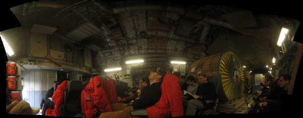
(8433x3306, 11261.95 kb) The view in the 17 from my seat. Try looking at this picture for five hours. That's sort of what the flight is like.

(4067x1265, 2944.89 kb) A view of the ice runway just before departing for the town.

(14224x1328, 9155.14 kb) A 360 degree panorama of the LDB camp. The cut is east of north, in the middle
of Mount Erebus (which is obscured by cloud). Starting from left, we have:

(6771x1155, 3641.60 kb) A view of one of the long drops against a background of snow and cloudy skies.
In the distance, a caterpillar is compacting the snow out on the runway. This
was actually my first attempt at the following panorama, but with everything
roughly the same shade of grey, I lost track of where I was in the shot, so I
decided to start again.

(8992x1264, 5177.10 kb) The view from Willy Field. On the left is Mt. Erebus, obscured by clouds,
roughly northwest. On the right, the most prominent land is White Island,
roughly souteast. The flags which run from the caterpillar rightward towards
White Island demark the Williams Field Skiway, which operates December to
February, and accomodates ski equipped aircraft, such as LC-130s and Twin
Otters.

(7808x1192, 4398.51 kb) This is essentially a continuation of the previous, but taken from another part
of Willy Field. On the left is White Island; next to it is Black Island, just
left of the pig barn. On the right of the pig barn is Mt. Discovery, with
Brown Peninsula next to it. Straight down the road, in the far distance, is the
Royal Society Range, on the continent. The next prominent peak in the near
background is Observation (Ob) Hill. McMurdo is on the other side, and the pass
between it and the rest of the highlands of Ross Island is where the road into
town goes. Ross Island, then provides the backdrop behind the storage berm in
the midground. The most prominent peak right of Ob Hill is Castle Rock. The
foot of Erebus is obscured on the right edge.

(6287x1348, 4255.21 kb) A view from McMurdo across the ice runway to the south. On the left is the foot
of Ob Hill. Black Island is partially obscured by clouds, almost due South; to
the right of it, Mt. Discovery pushes above the clouds. Continuing rightward,
is Brown Peninsula, and then the Royal Society Range. Peaks further right are
part of the Asgard Range, where the dry valleys are. Out on the ice runway,
five LC-130 "Hercules" are sitting.
Buildings in the foreground include, from left:

(6452x1073, 3296.08 kb) Another shot looking over the the ice shelf from McMurdo. At left is the foot
of Ob Hill. At right is Hut Point.

(3864x1260, 2770.70 kb) Winter Quarters Bay, at the west end of the base. In the winter of 1901/02
Robert Scott's ship Discovery was iced in here, hence the name. During
this time they built Discovery Hut (now usually called Scott's Hut) on Hut
Point. Winter Quarters Bay is the main deep water port for Ross Island and,
when it warms up, they'll have an ice pier here. In former times Winter
Quarters Bay was considered one of the most polluted places on Earth, but
significant clean up has happened since then.

(9448x1352, 8312.19 kb) The horizon for Willy Field from East to North annotated with prominent landmarks, and directions. The directions are approximate and may be off by a point or so.

(11376x1232, 8718.94 kb) The horizon looking the other way: from West to South, again annotated as above.
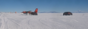
(4108x1376, 2997.30 kb) The otter at Willy Field. Unfortunately the middle panel in this panorama isn't crisp enough.

(5654x1243, 4001.76 kb) After taking the above panorama, I turned around and took this one of the LDB
Camp. On the left is a large collection of support vehicles. Past that is the
storage berm. Near centre are the LDB buildings and on the right is the
partially buried Pig Barn, the location of the old LDB camp.

(8088x1256, 5229.17 kb) The view of McMurdo from up near the Scott Base Road at night. At left is a row
of sea crates. At right is Arrival Heights and the Scott Base Road. Buildings in this photo include, from right:
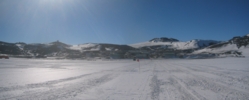
(3162x1272, 2330.19 kb) A view of McMurdo from the ice shelf south of town. Arrival Heights is at left. Crater Hill is just right of centre. At right you can make out the Gap between the Fortress Rocks and the slopes of Ob Hill.
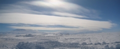
(3024x1254, 2062.91 kb) Erebus and Terror among the clouds.
![]()
(18999x1100, 10123.72 kb) A 270 degree panorama from near the Erebus Glacial Tongue in Erebus Bay. The
road I'm standing on here is on annual sea ice, which should melt sometime later
in the year, depending on sea conditions. When this ice melts, this area will
form Erebus Bay. The line of pressure ridges demark the Erebus Glacial Tongue,
a long glacier which sticks far out into the bay and doesn't melt with the
seasons. The tongue is now mostly buried beneath the snow because this ice
hasn't melted for a few years, due to icebergs partially blocking McMurdo Sound
further to the north for the past few years, which has led to less meltage.
Mount Erebus is at left, north of northeast. Near centre, just left of the road you can make out Castle Rock and the rest of Hut Point Peninsula. On the right side of the road is first Black Island, and then Mount Discovery. In front and slightly right of Discovery is the low-lying Brown Peninsula. Then comes Mount Morning and then a gap where the Koetlitz Glacier is. On the other side of the glacier is the Royal Society Range. The next gap is the Ferrar Glacier. To the right is the Kukri Hills, and then the Asgard and Olympus Ranges, where the famous dry valleys are. At right is Granite Harbour.

(13639x1364, 10362.37 kb) A 360 degree panorama of Cape Evans from the sea ice. The cut is roughly
north. Just right of the delta are the cliffs of the Barne Glacier. Beyond
the glacier you can just make out the hills of Cape Royds, where Shackelton's
Hut is. Omnipresent Erebus smokes away left of centre. The highlands to the
right of the volcano is Turks Head Ridge. Following the line of people you'll
find Scott's Terra Nova Hut, half buried in snow. Just left of the
orange fish hut is Wind Vane hill with a cross on top. To the right of the
fish hut is Cape Evans proper, and, much more prominently, Inaccessible Island
further right. To the northwest, beneath the sun are the Transantarctic
Mountains. The prominent glacier reflecting the sun is probably Mackay Glacier,
which falls into Granite Harbour at the north end of the dry valleys area.
There are two Mark Halperns in this image, as well as Matt's disembodied shadow. Try to find them, if you'd like. Note that the sea ice here is largely clear of packed snow, since this ice is only a year old. The sea ice on the other side of Ross Island, where Willy Field is, never melts, so it has accumulated many seasons of snow. Note also the sundogs.

(13677x1364, 9831.72 kb) Another 360 degree panorama of Cape Evans, this time from the top of Wind Vane Hill. The cut is southeastish, in the middle of the Turks Head Ridge. Turks Head itself is the bare headland sticking out into the bay. The glacial tongue follows to the right, leading to Little and Big Razorback. The other island just
to the Left of Little Razorback is Turtle Rock, which is considerably further
away. Castle Rock and the rest of the Hut Point Peninsula can be seen behind
Big Razorback. To the right of Hut Point, in the distance is Black Island;
closer and to the right is Tent Island, and closer still is Inaccessible Island.
Several ranges of the Transantarctic Mountains can be seen behind the cross.
Above the hut are the cliffs of Barne Glacier, and Mount Erebus, to the east,
is at right.

(6704x1375, 4671.97 kb) A panorama from the ice road showing Turks Head at left, Little Razorback, Turtle Rock in the distance, Big Razorback, and then the Hut Point Peninsula.

(6198x1017, 2894.18 kb) Whiteout conditions looking north to east from the highbay. If you could see it, Erebus would be at left.

(4544x1344, 2837.18 kb) Looking towards Hut Point Peninsula, where clearer skies can be seen.

(9340x1160, 5038.18 kb) The view towards Mount Discovery as we boarded Ivan when we headed back early
due to weather. In addition to the ominous looking clouds, there are also a
number of large snow vorticies in the distance.

(10456x1400, 6994.17 kb) The view southeast from station, looking over the ice runway. Despite the view,
weather at McMurdo was pleasant.

(13574x1287, 9033.73 kb) The view from the top of Observation Hill. The cut is northeastward, in the
middle of Mount Terror. There are two roads at left, the lower one is the Scott
Base Road. The upper one heads to the T-Site, which can be seen at right.
Scott Base, on Pram Point, can bee seen just in front of the pressure ridges.
In the distance is the LDB Camp at Willy Field. Another road down the hill to
the ice can bee seen directly below LDB Camp. This road is closed and of unknown
use. On the horizon across the ice are White Island, Minna Bluff, Black Island,
Mount Discovery, Brown Peninsula and then the Royal Society Range. The ice
runway is below and all of McMurdo Station can be seen to the right. Above
McMurdo is Hut Point. To the right of Hut Point is Arrival Heights, with White
Dome (in front) and Grey Dome (behind). Beyond Grey Dome is Tent Island and
Inaccessible Island. Castle Rock is prominent at right, with Erebus behind it.
At far right is the T-Site (where T stands for Transmitter), on top of
Fortress Rocks, with Crater Hill behind it. The transmitters on the T-Site
communicate with the satellite uplink on Black Island to provide all
communication to and from McMurdo.

(6184x1432, 4504.69 kb) Gaelen, Matt and Marie head back from Scott Base. The view from Scott Base is nicer than the one from McMurdo. White Island, Black Island and Mount Discovery
are in the background.

(5220x1298, 3461.43 kb) The western side of Hut Point Peninsula from the Ice Runway road. Below Grey
Dome are the Danger Slopes where Seaman Geo. Vince perished during Scott's first
expedition. Vince's cross is is on Hut Point. Behind Hut Point is McMurdo, and
behind that is Fortress Rocks with th T-site on top. At right is Observation
Hill and Cape Armitage.

(8000x1216, 5778.32 kb) Ice fog on the horizon to the south.
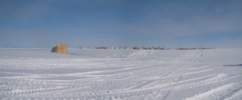
(2931x1212, 2039.15 kb) The pig barn with Willy Field behind.

(3015x414, 679.13 kb) Some standing clouds in the lee of Erebus and Terror on an otherwise clear day.

(8925x1264, 5440.26 kb) Willy Field airfield. At right, in the distance is Ob Hill. Six of the seven
LC-130s are on the ground here. The Terra Bus has just finished picking up
PAX from the rightmost Herc. The Basler sits at centre. On the left are the
support Buildings, and storage. At right in the background is LDB Camp.

(4396x1224, 2559.47 kb) ANITA on the flightline during inflation.
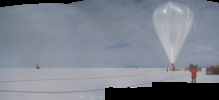
(3936x1796, 3086.96 kb) ANITA waits for launch...

(13544x1264, 8222.89 kb) Ed and Enzo walk out to the launch vehicle after rollout.

(7216x1288, 4727.28 kb) Awaiting inflation.

(6760x1424, 4840.88 kb) Early stages of inflation.
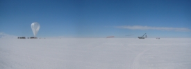
(3584x1304, 2364.73 kb) Late stages of inflation.