
(1345x2668, 719.00 kb) A spire from the Art Centre removed as an earthquake precaution.
These pictures were taken, like the rest of the shots, with my camera, but then aligned using autopano-sift, stitched together using the hugin front-end to the Panotools library, and then blended using enblend. Some final cropping and touch ups are done with The GIMP, and, lastly, the images are converted from TIFFs to something more Web-friendly using ImageMagick.

(1345x2668, 719.00 kb) A spire from the Art Centre removed as an earthquake precaution.
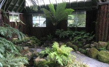
(3218x1973, 2164.74 kb) The fern house at the botanical gardens.
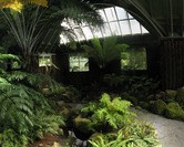
(5428x4343, 6137.86 kb) The fern house at the botanical gardens.

(10767x2088, 4672.51 kb) On the beach at Kaikoura.

(8565x2456, 4080.64 kb) Seals on the beach.

(9378x2462, 3748.86 kb) Whale watching. The Kaikoura Peninsula can be seen in the background.

(8504x2426, 2939.90 kb) Sunset over a vineyard outside of Blenheim.
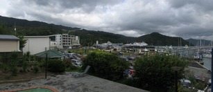
(6154x2666, 2965.50 kb) New Year's Day in Picton. An interisland ferry is in port.

(7585x2383, 4406.27 kb) A random beach in the Queen Charlotte Sound.
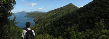
(7203x2594, 3645.44 kb) Grant looks down over Endeavour Inlet.
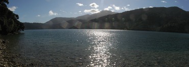
(6694x2405, 3329.02 kb) A beach on Queen Charlotte Sound.

(9235x2493, 4337.66 kb) Looking north towards Cook Strait.
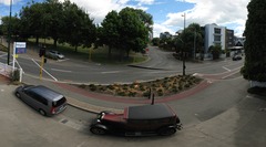
(9967x5514, 10854.40 kb) The view from the second floor balcony of the Windsor. At left is Cranmer square. The Windsor is on Armagh Street.
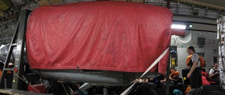
(5930x2504, 3240.96 kb) The view from my seat on the C17.

(8479x2458, 2908.16 kb) Arriving at Pegasus.

(11572x2505, 4114.43 kb) The view from Pegasus.

(11293x3193, 7159.81 kb) On the LC-130. The pile in front of us is our carry-on. The next pile is the crew's gear. At the back, on the ramp, is our checked luggage and a few other things for Keck.
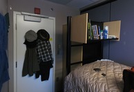
(6299x4309, 4958.21 kb) Looking the other way in my berth. Some of the stuff listed above which were not shown now is.

(22671x2239, 7944.19 kb) A 360 degree panorama from the Dark Sector road, where it intersects the
aircraft taxiway. The cut is roughly Grid Northeast. The first building
starting from the left, just right of an antenna mast is ARO, the Atmospheric
Research Observatory, at the edge of the Clean Air Sector. Then there's a
bulldozer grading the ARO road. Then comes another antenna, and then the
Ceremonial South Pole (surrounded by national flags).
A black line in the snow right of the Ceremonial Pole is the fuel line; then comes the elevated station. There are a large number of support buildings right of the Elevated Station, ending with the radar dome. On the far side of these is the Quiet Sector. Then comes the ski-way (ie. runway), which marks the edge of the Dark Sector.
Most of the next stuff is storage up on snow berms before we get to the Ice Cube Laboratory, followed by a generator building and then the Dark Sector Laboratory (DSL) containing the imposing South Pole Telescope, and the much smaller BICEP2. Next is the Martin A. Pomerantz Observatory (MAPO) where Keck is being built. The large orange flags in the Dark Sector indicate the locations of the Ice Cube strands. At right a the black flags (which indicate danger) mark out the location of Old Pole (the station built in the 1950s and now buried). The red tents on the horizon is the Designated Camping Area, where tourists are allowed to stay.
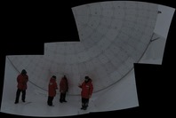
(7614x5127, 3868.67 kb) It's hard to take a picture of SPT's primary from such close quarters, so I did this instead.

(10785x2398, 3511.30 kb) A view of the Dark Sector and the Station from atop SPT.

(1848x3651, 1068.03 kb) A look into the Viper ground shield.

(10573x2502, 34201.60 kb) A view of the outbuildings Grid South of the Elevated Station from the top of
the snow pile near Destination Alpha. The edge of the Elevation Station is at
extreme left. The next building on left, with all the garage doors is the
cryogenics facility, one of the few out buildings kept open in winter. Behind
it is the waste facility. Most of the Jamesways (the long, semi-circular tents)
form Summer Camp, overflow housing in use during the summer. A lot of the rest
of the stuff you can see are storage berms. The white radar domes can just be
discerned against the whiteout conditions. To the right is the aircraft
refuelling yard, and the passenger (PAX) terminal. At extreme right, on the
other side of the fuel line, is the IceCube drill camp.

(12325x2149, 3645.44 kb) Arrivals and departures at the flight terminal (aka Peligroso).

(16181x2173, 51148.80 kb) The view of the marathon from the second floor balcony.

(15087x2034, 5618.69 kb) The view from Destination Zulu. The bins on the right are trash sorting bins.
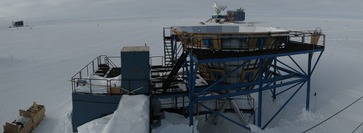
(7036x2579, 3015.68 kb) Overlooking the Viper ground shield.

(23893x2233, 7367.68 kb) A 360° panorama taken from Grid South of the Elevated Station. Most of what you
see are storage berms, but we also have, starting from left:

(13515x2403, 4646.91 kb) The two Stations: At left is the Elevated Station where I live, eat and
sometimes work. The cylindrical metal structure on the right end of the
station is the Beer Can. It connects the Elevated Station to the Underground
Station. The two quanset-like buildings you see in the centre, mostly burried
by snow are the entrances to the Underground Station, which are the left-over
parts of 2nd Pole (the "old" station which more people are familiar with: the
one that used to have the geodesic dome). They weren't originally underground,
but have been buried by accumulation since they were first constructed. These
are mostly utility structures and house things like fuel storage, the power
plant, the vehicle shop, &c. At right, past the row of snowmobiles, is the
cryo facility, one of the few outbuilings which remains in use over winter.
It's used to store gasses and liquid cryogens (like liquid helium) for use by
scientists.

(7401x1664, 2543.62 kb) A mildly fish-eyed view of Science taken from the mezzanine stairs. Science is
one of the larger rooms in the Elevated Station, but it is well utilised. In
the far corner at left is the Met Office (that is, the weather guys), next is
the large IceCube area. Straight ahead, under the clock, is the SPT area. In
front of that is where we and BICEP2 have set up shop. (You can just see the
top of our desk.) Over on the right is the domain of the atmospheric
scientists.

(24708x2453, 10823.68 kb) One last 360 degree view of South Pole from the Dark Sector Road. There are stitching issues.

(8264x2408, 3405.82 kb) South Pole Station from Peligroso.

(7438x2440, 2520.06 kb) Winter Quarters Bay, where the USNS Richard G. Matthiessen awaits lading, with the Royal Society Range on the horizon.

(11021x2500, 5905.41 kb) Chin-Lin checks over the operations in Winter Quarters Bay from Hut Point. The prominent hill at centre is, of course, Ob Hill.
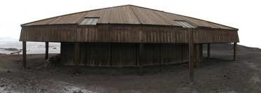
(6798x2423, 2864.13 kb) Scott's Discovery Hut at Hut Point. It was a pre-fab outback cabin from Australia. Apparently it works quite well at keeping things cool, which wasn't really what they were after.

(23976x2406, 8452.10 kb) A 360° view from the end of Hut Point, where Vince's Cross would be had I not cleverly removed it from this image. At left, looking roughly west, you can see the inbound icebreaker on the horizon. Hills on the left are known as Danger Slopes (where Vince fell to his death); on the other side of White Dome, the hills are known as Arrival Heights. Discovery Hut is in the midground, with Winter Quarters Bay behind it, and McMurdo behind that. Then you can see Ob Hill, behind which is White Island, and next is Black Island, with Royal Society Range at right.

(10486x2497, 3767.30 kb) The icebreaker parked in McMurdo Sound, with crazy quantities of fata morgana on the horizon. This was taken from the "beach" down below the Station. At left is Cape Armitage, the foot of Ob Hill. At right is Hut Point, where you can see the roof of the hut itself.

(13155x2568, 7564.29 kb) PAX redeploying from McMurdo to Christchurch on a mostly empty C-17. This was the view from my seat, shortly after take-off. This is why you always opt for the cargo seating along the sides if possible: infinite leg room.
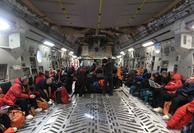
(6537x4474, 5984.26 kb) And the view noseward. Still lots and lots of room. Also some panorama generated re-arrangement of heads.

(11120x3596, 6742.02 kb) Caroline Bay, Timaru. The war memorial is the ring of pillars half way down the path. The rose garden is to the right.
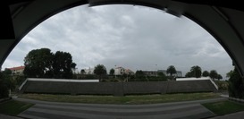
(7625x3708, 4235.26 kb) The view from the amphitheatre.

(8654x2571, 6715.39 kb) Trevor Griffiths Rose Garden.

(16681x2434, 6910.98 kb) Lake Tekapo, with the town at its south end, from the top of Mount John.

(8769x2457, 4005.89 kb) Looking north from Mount John. The difference in colouration between Lake Alexandra at left and Lake Tekapo at right is profound.

(10396x2566, 4246.53 kb) A very wet Mackenzie Valley.

(15545x2157, 6895.62 kb) Lake Pukaki (left) at the end of the Hydro Canal (right).

(10990x2493, 6882.30 kb) Mueller Lake below low cloud.

(13184x2542, 5870.59 kb) Aoraki from the Hooker Valley.
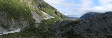
(7199x2468, 4547.58 kb) Looking down the Hooker Valley past the second swing bridge.
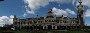
(6897x2578, 3115.01 kb) Dunedin Train Station.

(23882x2399, 10200.06 kb) A 360° panorama from the middle of Curio Bay.

(10880x2482, 6675.46 kb) Curio Bay.

(14281x2182, 4784.13 kb) Milford Sound. From left we have: the Devil's Armchair, the Llawrenny Peaks (in the distance, up the gully), Mount Phillips, Simbad Gully, Mitre Peak, the Sound, the Lion (distance), and the lower slope of Cascade Peak at right. Below the Devil's Armchair is the Milford Hotel, and the tree'd spit to the right of that contains the airstrip.

(19895x2497, 7203.84 kb) Lake Te Anau and the Te Anau townsite, with the mountains of Fiordland in the distance.